Leg 11: Venn Chapel to Coney's Castle
6.2 MILES
AN UNDULATING STAGE UNTIL THE STING IN THE TAIL. THE LAST MILE HAS THE LAMBERT'S CASTLE AND
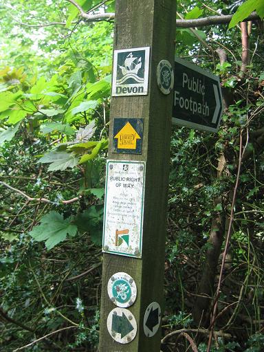
CONEY'S CASTLE HILL CLIMBS. THREE QUARTERS OF A MILE OF ROAD TO START AND ABOUT HALF A MILE MORE AT THE END. MOSTLY TRACKS AND CROSS COUNTRY . AFTER TWO MILES THE RIDGEWAY IS JOINED BY THE LIBERTY TRAIL, WHOSE YELLOW ARROWS ON A GREEN BACKGROUND IMPROVE THE MARKING FOR THE REST OF THE COURSE.
-
Runners will arrive at Venn Chapel along the road from the south. They will only be in sight briefly as they descend Blackdown Hill to reach the road just south of the chapel. The new runner heads west from the junction on the road signed 'Thorncombe'.
-
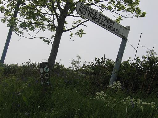
After half a mile the road crosses a river in Synderford village. After climbing out of the valley for another quarter of a mile, turn left into another lane signed 'Saddle Street'.
-
At the lane's end, go through the farmyard. Leave by a metal gate,
-
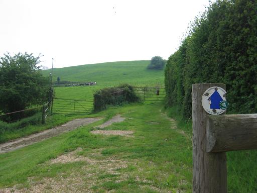
Turn left and after 50 yards turn right off the road through a metal kissing gate to run down the right hand side of a field. The 'Liberty Trail' markings start here. At the bottom of this long field turn left on to a concrete farm road.
-
Just past the farm house take the middle path, going slightly right.After 50 yards the track meets another track, turn right and follow it downhill. After about 300
yards take the kissing gate on the right and follow the left-hand hedge to the end of the field to another kissing gate in the corner of the field. Go into a conifer wood. Emerging, run round the right-hand side of the field to the far corner and go through a farmyard. Turn right into a lane and immediately left between the left-hand
hedge and some chicken coops. Cross the stream by a wooden bridge. Go up the hill keeping the hedge on your left. At the gate slant right across the next field to
two gates in the far right hand corner. Go through the right hand gate and keep the hdege on the left. Run up the field keeping the hedge on the left to the stile
in the top left hand corner of the field.
-
Turn left on to a lane. Keep straight on at the junction in 200 yards; but just after this fork right on to the higher of the 2 roads by the farm buildings. This deteriorates and curves right then left uphill. Ignore the bridleway sign on the right and keep on the track to emerge on to a busy road
(caution is required here!) after a quarter of a mile. Cross carefully into the minor road opposite passing a phone box. After 30 yards, turn right into Lambert's Castle. Keep right for the best line on the climb which curves left to a gate.
-
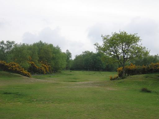
From the gate, climb slightly right then run the long axis of the fort. The summit is a large open area without waymarking.
then go through the right-hand gate onto a track, which curves right up the hill. Go through the metal gate ahead and turn left immediately up the hill next to the
hedge ignoring the track (the Monarch Way) across the field. Go through a style in the hedge on the left, next to an oak tree. Continue on the same line on the other side of the hedge. Go through a gate and keep to the right-hand hedge as it turns right. Go to a stile and continue across the next field to emerge into a road.
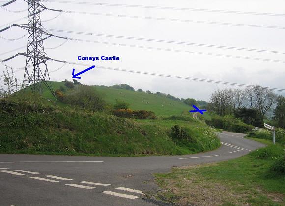
Drift across to the left edge of the hill to leave by a broad green track which descends to a road. Go ahead up the steeply climbing road with a pylon to the left. Once over the brow, you can see the changeover in front of the trees.
|
Find us on social media:
|
|||
|
|
|
|
|
|